|
Journal
Contact Us
Poems
Site Map
Search
| |
An American Territory, and an independent country, their
culture and backgrounds are similar - friendly people, exciting singing and
dancing made this one of our most pleasant stopovers.
|
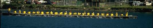
We anchored in Pago Pago harbor 9 days from Bora Bora, amid the odor of
the tuna factory. Traditionally put down as a dirty, unattractive destination - we loved
it! The people were as friendly as could be. Dragon boat
races as seen above livened up the harbor! Mail service
from the US was quick and cheap, restaurants were reasonable, and tours to the north and eastern shores were beautiful.
One downside was
the rain - sometimes we had to bail the dinghy twice a day to avoid
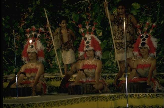
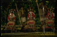
swamping it. The mini-Heva
festival held in October has wonderful Samoan singing and dancing plus a
re-enactment of a Kava ceremony.
|
 |
|
|
|
Previously known as Western Samoa, this country has changed its name since
our visit. The capital, Apia, is pretty but a little run-down. The
anchorage at Apia is secure, although the dinghy landing on a set of cement
steps appeared a little hazardous. Beaches on the South coast are
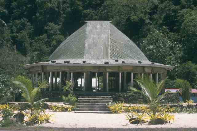
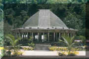
beautiful. Traditional homes are open falles as seen to the right. Open
plan, with high roof, no fixed walls (woven mats can be used to provide
privacy) - this type of structure is found across the South Pacific and
known as falles, fares, bures, ... all apparently from the same origin.
|
 |
The next stop was Tonga, border between
Polynesia and Melanesia |