|
Journal
Contact Us
Poems
Site Map
Search
| |
A trek in Nepal - this was a vision we
have cherished for years since seeing slides of the majestic Himalayas. We
spent 3 weeks in Nepal, 2 trekking to Gokyo Ri at 18,000', and had a
fascinating time. Read on and we'll share the highlights.
Kathmandu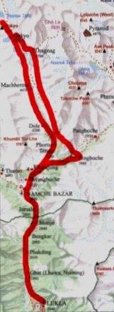
Kathmandu is an exotic city with Hindu and
Buddhist temples, busy streets, choking smog, and hawkers everywhere.
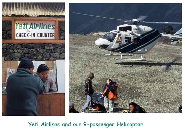
After 3 days we hopped a flight on Yeti Airlines (no kidding!) to Phlaphlu
and a helicopter hop to Lukla, the staging area for all treks going into the Mt.
Everest region. 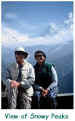 A meal of rice and potatoes, an introduction to the
'hole-in-the-floor' squat toilets, and we were off on a 3-hour trek to Phadking.
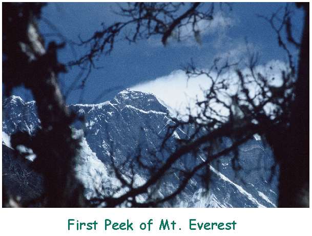
The next 2 days were tougher, as we climbed 800m (2500') to Namche Bazaar, an
ancient trading outpost between Nepalese farmers and Tibetan traders who crossed
the Himalayas to sell their wares. We also got our first views of Mt.
Everest A meal of rice and potatoes, an introduction to the
'hole-in-the-floor' squat toilets, and we were off on a 3-hour trek to Phadking.
The next 2 days were tougher, as we climbed 800m (2500') to Namche Bazaar, an
ancient trading outpost between Nepalese farmers and Tibetan traders who crossed
the Himalayas to sell their wares. We also got our first views of Mt.
Everest  and Ama
Dablam. and Ama
Dablam.
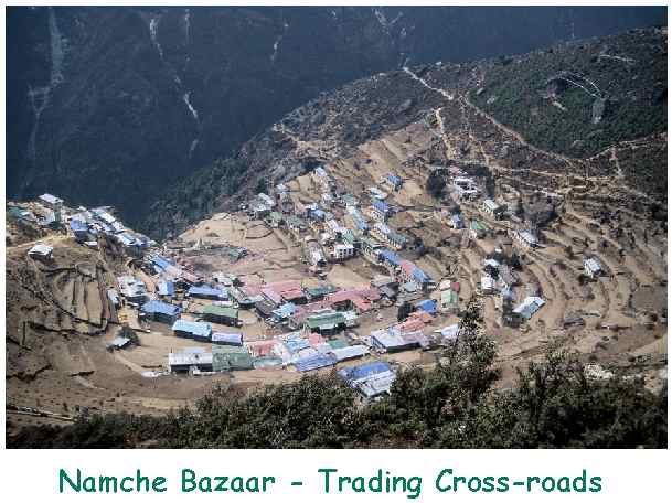
Namche Bazaar
For hundreds of years, Namche has occupied a horse-shoe shaped hillside astride the
Nepal-Tibet trade routes. Today, it also serves tourism, has electricity, a few
phones and even a couple of internet connections. All Everest expeditions
pass through and turn east towards Periche and the Everest Base Camp. We
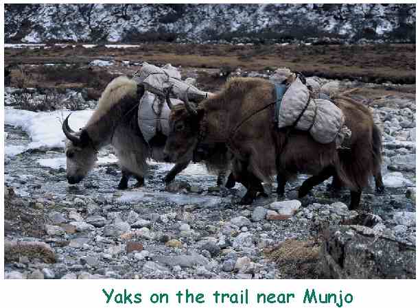
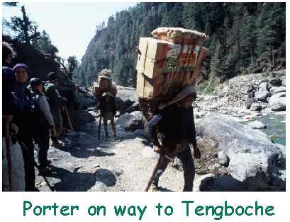
continued north through small villages, sharing trails with villagers, porters,
and yaks,
has occupied a horse-shoe shaped hillside astride the
Nepal-Tibet trade routes. Today, it also serves tourism, has electricity, a few
phones and even a couple of internet connections. All Everest expeditions
pass through and turn east towards Periche and the Everest Base Camp. We
continued north through small villages, sharing trails with villagers, porters,
and yaks,  continuing to climb another 1200m (4000') to
Gokyo lake, and the nearby peak of Gokyo Ri. continuing to climb another 1200m (4000') to
Gokyo lake, and the nearby peak of Gokyo Ri.
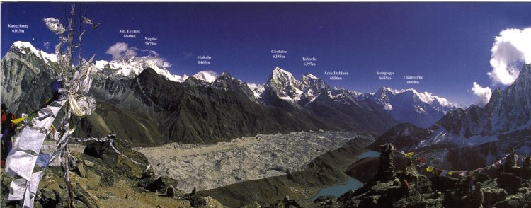
Gokyo Ri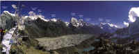
The wake-up call came at 4:00 AM at our campsite
and after hot tea and porridge 13 cold trekkers set out for the 18,000'
peak of Gokyo Ri, and, hopefully, a clear view of Mt Everest. It was a
tough, unrelenting climb and the thin air made us stop every 5-10 minutes to
catch our breath. But the views from the top were worth every step - 360�
views of snow-capped peaks, the Glacier winding through the valley below, and a
solitary figure wrapped in robes meditating on the mountain-top.  After
much picture taking and posing we returned to camp, tired but proud of our
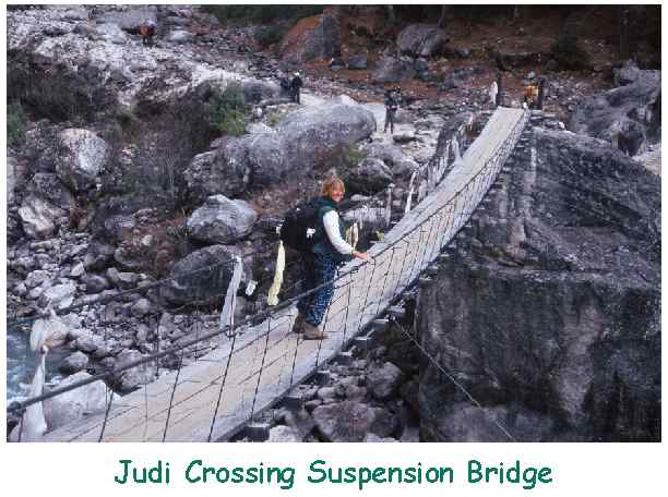
accomplishment. Over the next few days we gradually lost altitude as we crossed
a glacier, trekked up and down interminable hills, walked across many suspension
bridges, and finally arrived in Tengboche. After
much picture taking and posing we returned to camp, tired but proud of our
accomplishment. Over the next few days we gradually lost altitude as we crossed
a glacier, trekked up and down interminable hills, walked across many suspension
bridges, and finally arrived in Tengboche.
Tengboche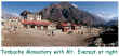
Tengboche is a famous Buddhist monastery on the
main trail between Lukla at the Everest Base Camp - and so is visited by all who
climb the Nepal side of Mt. Everest. It has wonderful views of the
mountains, and has a peaceful feel about it despite the number of trekkers who
stop here. During an evening visit we watched and listened to the monks as
they prayed and made offerings and were mesmerized by their chants and music. 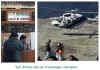 After
a relaxing evening by the fireplace in a near-by lodge we trekked gradually
downhill for the next 2 days After
a relaxing evening by the fireplace in a near-by lodge we trekked gradually
downhill for the next 2 days
Escape from Kathmandu
Back in Kathmandu we tried to see all of the attractions we had
missed earlier, but "traveler's tummy" plus a cough and the start of a
cold laid us low and we took it easy until our Royal Nepal
flight back to Singapore. 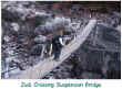 Overall we had a WONDERFUL time and recommend it
to any one. We went on a package tour with World Expeditions
of Australia
and were
quite satisfied. There are scores of operators in Nepal, lots of lodges
along the trails, and we met many backpackers of all ages who organized their
own trips. Next time: Annapurna! Overall we had a WONDERFUL time and recommend it
to any one. We went on a package tour with World Expeditions
of Australia
and were
quite satisfied. There are scores of operators in Nepal, lots of lodges
along the trails, and we met many backpackers of all ages who organized their
own trips. Next time: Annapurna! |


 [
[